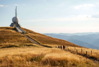
BR73 From the alsatian wine road to the Grand Ballon
Vélo Mulhouse et sud Alsace
Spring
Summer
Fall
Profil Altimétrique

Departing from Cernay, the route follows the Thur Valley cycle route towards the Kruth lake, set in a veritable green setting. Along the way, a visit to the Parc de Wesserling, a genuine 19th-century textile town with park, garden and château covering more than 42 hectares, is a must. The climb that follows is a particularly challenging one, taking you along the ridge towards the Markstein, which rises to an altitude of around 1,200 metres, and the Grand Ballon, with its pass at 1,348 metres. The panorama is grandiose and richly deserved. The descent is via the Col Amic, a classic Tour de France stage. It then joins the Alsace vineyard cycle route at Soultz-Haut-Rhin. The route then gently winds its way back to the starting point.
Gallery