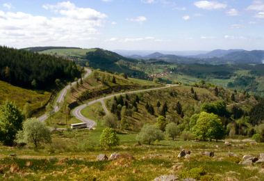
BR33 - The upper valley of the river Bruche
Schirmeck
Schirmeck
Vélo Colmar et centre Alsaceet nord
Spring
Summer
Fall
Profil Altimétrique

Departing from Schirmeck, hikers set off to discover landscapes of remarkable serenity. The route begins in the Framont valley towards Grandfontaine and the Col du Donon, under the protective gaze of the majestic Temple of the same name. The tour continues in Vosges territory through the Rabodeau valley to Moussey, after crossing the Col du Prayé. Back in the Bruche Valley at Saulxures after the Col du Hantz, the route then follows the final stretch of the superb VéloBruche to Saales. A short incursion into the Climontaine valley at Colroy-la-Roche and Ranrupt before reaching the Col de Steige. Afterwards, hikers can discover the legacy of Pastor Oberlin at the eponymous museum in Waldersbach. The tour then continues to the highest point in the Bas-Rhin, the Champ du Feu, a dynamic 4-season resort. Afterwards, the duty of remembrance leads the hiker to visit the Struthof Concentration Camp Memorial and the European Center for Deported Resistance Members at Natzwiller, in the Rothaine Valley, before returning to the starting point.
Gallery